Kirkby Lonsdale
It is not certain that Kirkby Lonsdale ever had a castle, but due to confusion between this site and Kirkby Kendal a short piece has been produced to highlight the differences.
The words Kirkby and Lonsdale are used to differentiate this place from the relatively nearby Kirkby Stephen and Kirkby Kendal.
The word Kirkby itself is thought to signify ‘the church
settlement' and this strongly suggests that this settlement with church
was of pre-Viking origin. The early history of this district is
probably similar to that described under Cumberland.
In 1066 Kirkby Lonsdale was recorded as being held by Torfin as one of
his 12 manors in Austwick. It had passed into the king's hands by
1086. There is therefore the possibility that this king may have
been responsible for having the line of the River Lune fortified with
various mottes in the second half of his reign. These ran
northeast on either side of the river from Lancaster to Tebay castle.
The bulk of these mottes lie south of Kirkby Lonsdale and consist of
Whittington, Arkholme, Melling, Hornby and Halton. Only Sedbergh
and then Tebay lie north of Kirkby, while Burton in Lonsdale
lies some distance southeast of Kirkby, possibly acting as a
backstop. All of these are motte fortresses and only Melling and
Whittington lack baileys, probably through their having been built over.
Sometime, probably within 5 years of Domesday, Kirkby Lonsdale was
given to Ivo Tailbois (d.1094/97). Ivo was a powerful figure in
the North and before his death he granted to St Mary's abbey of York
the services of half his lordship of Kirkby Stephen (Cherkaby Stephan) with the church and tithes, land in Wytuna and the churches of Kendal (Kircabi in Kendale/Cherkaby Kendale), Eversham and Kirkby Lonsdale (Cherkeby Lonnesdala) as well as the lands which pertained to them, namely the vill of Hutton, the church of Beetham (Bethome), the land called Haverbrack (Halfrebek) and the churches of Burton [in Kentdale] and Clapham (Clepeam,
Yorkshire). With this, control of the land passed out of his
hands, with St Mary's holding ¾ of the modern township of Kirkby
Lonsdale, the remaining portion, based on Deansbiggin, being held from
the barony of Kendal.
The main manor of Kirkby Lonsdale seems to have belonged to the Crown, for on 20 September 1227, King Henry III (1216-72) granted Parson John Kirkby of Kirkebi in Lounesdale
and his successors a yearly fair ‘on the land of that church' and
a weekly Thursday market. The point of control was emphasised
again in 1230 when an assize of 8 knights ‘not being of the fee
or affinity of William Lancaster (d.1246)' was called for by the Crown
to judge whether John Kirkby's holdings belonged to the fee of William
Lancaster of which William's ancestors were seised as of their lay fee
in the time of King Richard
(1189-99) or whether they belonged to Richard Copland. John was a
descendant of the Ketel who held the land from at least 1130 onwards
and this land eventually descended to the Coplands. A quarter of
Kirkby Lonsdale was held by Alan Copeland from William Lindsay, lord of
a moiety of Kendal in 1282. It would
therefore appear that St Mary's held ¾ of Kirkby Lonsdale direct
from the Crown, while the other quarter was held by tenants of the lord
of Kendal. No mention was ever made of a capital messuage or a castle here.
Description
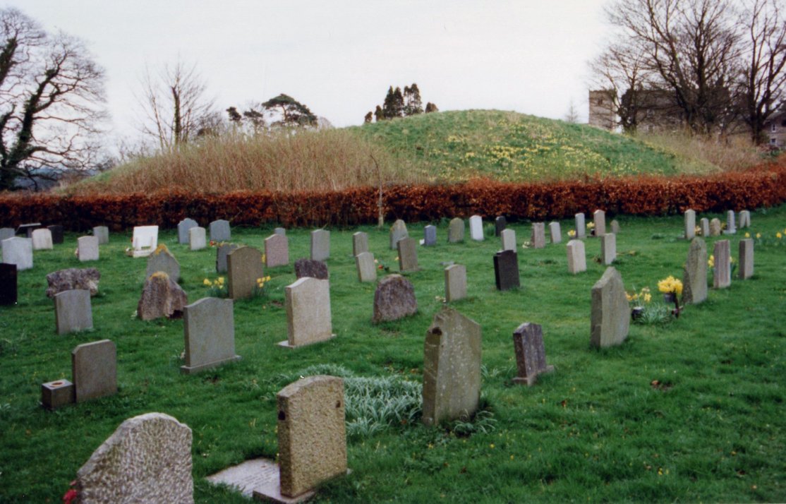
The ‘castle' stands at an obvious fording place above a tight
bend in the River Lune on the west bank some ¾ of a mile upriver
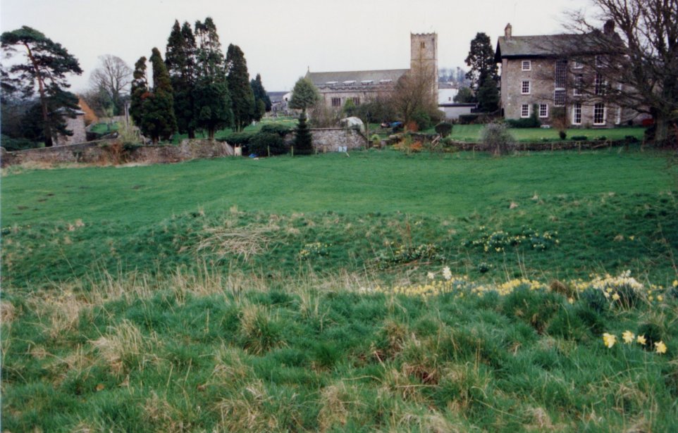
of the Devil's Bridge, while Kirkby Lonsdale church stands at the
northern end of the old Saxon? settlement. Some 500' north of
this stands a slumped mound immediately above the river bluff.
Known as Cockpit Hill, the mound stands about 20' high and has a basal
diameter of some 130'. The whole is highly irregular and
collapsed, possibly having its east side dug partially away. A
ditch surrounds the mound on all side except the east, where it may
have been washed away by the river which obviously changes course in
it's floor plane - the recently forming oxbow lake being ample evidence
of this. Landscaping and paths have further damaged the
structure, while a pit seems to have been dug in its summit.
Maybe this was a cockpit, which gives the mound its name.
Copyright©2023
Paul Martin Remfry