Buckton
Buckton castle stands on the western edge of the Peak District a
little over a mile east of Mossley and under 4 miles from the Domesday
vill of Ashton under Lyne. Like most northern castles its early
history is mostly obscure and consequently conjectural. The area
seems to have lain in Salford Hundred in Cheshire and was therefore
held by Earl or Count Roger of Poitou (d.1123) at Domesday. This
apparently wasted hundred included the vill of Manchester and its 2
associated churches at Ashton-under-Lyne and Radcliffe, as well as
Rochdale. Unfortunately the other 20 manors between the rivers
Ribble and Mersey were only mentioned as held by Saxon thanes, but not
differentiated. Further there was the royal domain which
accounted for about a third of the district and was concentrated in the
centre of the region.
Count Roger's other Domesday possessions straddled Yorkshire,
Lincolnshire, what was to become Lancashire, Nottingham & Derby,
Suffolk, Essex and Hampshire. More relevant to Buckton, Roger had
supported King William Rufus (1087-1100) in his annexation of Cumberland in 1092 and reaped rewards in the North as well as the honour of Eye
by 1096. In what was to become Lancashire his control after 1092
advanced from the River Ribble north to the River Lune allowing him
control as far north-west as Furness in Cumberland.
In 1102 Earl Roger lost all his English lands during the rebellion of
his elder brother, Earl Robert Belleme. In consequence Roger
retired to his wife's lands in Poitou and King Henry I
(1100-35) disposed of his escheated English lands as he saw fit.
Buckton may have part of the lands of Roger Poitou (d.1123) that the
king passed onto a man called Robert as this person was certainly given
Anley, Otterburn and Scosthorp from Roger's domains. This Robert
was later known as Robert Romiley and is probably identical to the
Norman Robert who was apparently the son of Remfry (Rainfred,
d.c.1086), the first Norman abbot of Whitby. Robert possibly
took the surname Romiley from the Cheshire Domesday vill of that name
which lies only 8 miles from Buckton. This suggests that the
English vill of Romiley is more likely the province of that family's
surname than one of the multitude of Romillys in France as has usually
been claimed without contemporary evidence. However, there is
also a possibility that he came from Remilly sur Lozon as a Rumilleio
in Lower Normandy was granted to Aunay sur Odon by his
descendants. Presumably the Remfrys came from Le Mesnil Rainfray
some 40 miles south of Remilly sur Lozon. Before 1103 Robert had
also acquired various other English lands including Mappowder in
Dorset, Molland, Spitchwick and Warkleigh in Devon and Wheatenhurst in
Gloucestershire, all of which he had given to Troarn abbey in Normandy
before 1103, but after 1086. The first 2 of these places were
rich royal vills, while Wheatenhurst was not a royal vill and Warkleigh
did not appear in Domesday. This suggests that Robert was well in
the favour of either William Rufus, Henry I, or both kings.
The suggestion that Robert's surname came from the English Cheshire Romiley is strengthened by the Domesday Book name of Rumeli
being used in exactly the same form by Robert's daughter, Cecilia, in
the mid twelfth century. Her sister, Alice was recorded as Rumeili.
The French Remilly sur Lozon was granted to Aunay abbey by Jordan Say
(d.1151) and his wife Lucy, the daughter of Robert Romiley.
Consequently it cannot be proved as to whether this Rumilleio
was the property of Jordan or his wife. That said Remilly sur
Lozon was latter associated with the Say and Hommet families. In
any case the Remfry/Romiley landholdings in Normandy have not yet been
fully explored.
In England, Romiley was held by Earl Hugh of Chester (d.1101) in 1086
as part of Hamestan hundred and contained 1 virgate of land. The
hundred ran from Bosley beneath Macclesfield in the south to
Tintwistle, just 3 miles from Buckton castle, in the north.
North-west of Hamestan hundred lay the lands of Roger Poitou and
north-east the lands of William Peverel of Peak castle.
If Robert Romiley was the lord of Buckton castle he also seems to have been the founder of Skipton castle,
which began life as a motteless partial ringwork lying against a steep
fall of land. This is somewhat similar to the position of Buckton
on top of its mountain. Robert died before 1120 when one of his 2
surviving daughters, Cecily Romiley (d.1151/55), founded Embsay priory
with her husband, William Meschin of Egremont. Embsay had been linked to the royal vill of Skipton in 1086 and had been apparently granted to Robert Romiley with the crushing of the Shrewsbury rebellion in 1102 by Henry I.
William Meschin, both with and without his wife, seems to have granted
Skipton church to 2 independent religious houses in an unusual
move. Henry I confirmed the grant of William Meschin alone of his land of Dena and the church of St Trinity of Scipeton
to Huntingdon at some point between 1125, when one of the witnesses,
David (d.1153), became king of Scotland and before 1134 when William
himself was dead. Some time earlier between August 1100 and 1107
he and his wife, Cecily (d.1151/55), had granted the church of St
Trinity of Skipton of her honour of Skipton
to Troarn abbey. As Skipton was the inheritance of his wife it is
most unusual that William made the latter grant without his wife's
permission, as had appeared in the first charter to Troarn. As
William's wife survived him and went on with her second husband, Henry
Tracey of Barnstaple (d.1165),
to confirm the first grant to Troarn, it is possible that Henry was
acting against his wife's wishes after 1124. Possibly this is why
the first grant eventually prevailed, although there was a long running
dispute over Skipton church with the
cannons of Huntingdon. The implication of the second grant is
that William Meschin was courting the favour of King David of Scotland
(d.1153), who from 1113 had been earl of Huntingdon.
Buckton castle, its style suggesting it had an eleventh or early
twelfth century origin, may have been destroyed by William Fitz Duncan
(d.1153), the onetime heir to the Scottish throne, in the late
1130s. This may have occurred after the battle of Clitheroe
on 10 June 1138. Alternatively, the castle may have met its end,
again at the hands of Fitz Duncan, in 1151 when Symeon's chronicle
noted:
And then the king [David] with his army confirmed William Fitz Duncan, his nephew, in the honour of Skipton and Craven and broke into the small fortresses that had been built by the enemy and destroyed them after ejecting the knights.
Possibly then, this was the fate of Buckton castle, but it should be noted that both Skipton and Clitheroe were just over 30 miles north of Buckton and the boundary between Fitz Duncan's land and Earl Ranulf of Chester (d.1153/54) seems to have been set at the River Ribble, some 20 miles north of Buckton.
Regardless of the historical evidence, the castle never seems to have
been mentioned in the Norman era, which suggests that it was destroyed
before records began to proliferate in the mid twelfth century.
If it simply faded away it may just have passed with the Romiley
holdings to William Fitz Duncan (d.1153), even though this was well
south of the Ribble. The fate of the Romiley fees are looked at
under Skipton. It is possible that
with the reorganisation of the northern counties on the fall of the
earl of Chester in 1153/4 and the expulsion of the Scots from
Lancashire soon afterwards, the castle might have passed to the earldom
of Cheshire where it remained as the north-eastern extent of the
honour. The Henrician rearrangement of the Scottish border is
discussed under Cumberland and its associated castles.
It has also been suggested that Earl Ranulf of Chester (d.1153/4) may
have built the castle to protect the Cheshire plain from his Scottish
enemies who lay north of Buckton at Skipton and Clitheroe and from William Peverel who held lands immediately south of Buckton as well as Peak castle
some 15 miles away. Although possible this is an extremely simple
castle in a highland position, so an earlier date than the 1140s seems
more likely for its construction. Further in 1173, when the earl
of Chester revolted against Henry II, such minor castles as Dunham Massey and Ullerwood in Cheshire were recorded as garrisoned by Hamo Mascy and Chester
itself by Earl Hugh (d.1181). If Buckton were then in the sphere
of Earl Hugh it would probably have been mentioned as defying Henry II.
Certainly it would seem more powerful than the other 2 minor Cheshire
fortresses. This, and its simple design, suggests that the castle
was already ruined and indefensible before the great revolt of 1173.
The idea that William Neville (d.bef.1211), who was granted the
lordship of Longdendale by the earl of Chester in 1200/03, built the
castle seems most unlikely as he would have been building a fortress
roughly a hundred years out of date in both style and position.
Similar castles in style to Buckton exist at Hay on Wye and Lydney, although the motte and bailey castles of Egremont and Tickhill bear some similarities too. Although it has been claimed that the thirteenth century Beeston castle resembles Buckton some 40 miles away, there is little to recommend this theory in size, history or design.
By 1360 the site of Buckton castle was within the old Neville/Burgh
lordship of Longdendale, a part of the earldom of Chester, just granted
to the Black Prince
(d.1376). A survey of that year described it as a ruined castle
and hinted at it having had a chapel. Obviously it was no longer
functional, but it is impossible from this to state at what time the
fortress had been destroyed or abandoned. All that is certain is
that when Ormerod saw it in 1817 there was no trace of masonry at the
site or indication that it had been a castle, rather than a hill fort.
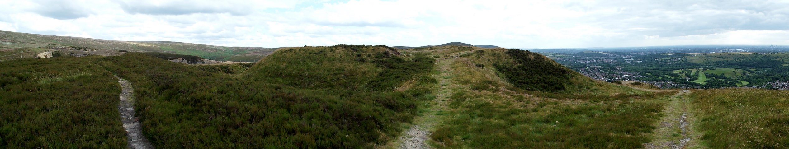
Description
Buckton castle stands on a shoulder of Buckton Moor projecting strongly
to the north-west and commanding the northern Cheshire and southern
Lancashire plains. On the south-western side of the summit is an
irregular D shaped ringwork varying between 115' and 130' in
diameter. It's south-western face is straight, while the curved
section is elongated to the north-west to accommodate an odd rectangular gatetower.
The rest of the enceinte is enclosed by a simple 6' thick curtain wall,
whose foundations are still exposed here and there, especially to the
west. The site is protected to the south-west by the scarp of the
hillside, while on the other sides there is a ditch up to 30' across
and 20' deep. The supposed bailey to the ringwork has been shown
by excavation to have been a second world war decoy site.
The gatetower would appear to
have been an unusual rectangular structure, about 31' by 25' with a
guard tower to the west and a gate passagway to the east. The
walls were considerably thinner than the adjoining curtain at
about 4' wide. Presumably it was of 2 storeys, although the
narrow walls may preclude this. This is an unusual structure and is not
parallelled elsewhere in the British Isles. As such applying a
late eleventh century date to the structure seems more reasonable than
one a hundred years later.
The only right angle in the enceinte was to the west and this suggests
that the great hall was here, alongside the gatehouse guard tower and
running south-east along the straight south-west curtain. A well
is supposed to have existed against the south curtain along with
further buildings that were still standing some 6' high in the
eighteenth century.
Excavations earlier in the century revealed that the castle had 3
identifiable phases. First came the digging of the ditch and the
building of the masonry castle. This survived long enough for the
ditch to be recut and building work to take place in the
interior. Finally the castle was deliberately demolished.
Taken together this suggests that the castle was probably built for
Roger Poitou before 1102, refortified by Robert Romiley or another lord
in the early twelfth century and then destroyed in 1138 or 1151 by
Scottish forces. Consequently the castle saw no action in the war
of 1173-74. Sadly little dateable material was recovered from the
site, which may indicate little activity. What was found, merely
4 shards of Pennine Gritty Ware, could only be broadly dated as twelfth
century. Paleoenvironmental evidence also showed that the
mountains had been deforested by the ninth century and that the
fortress was constructed on land clear of woodland. This was
claimed to be the reason for this ‘early castle' being built in
stone from the first. However, if you dig a rock cut ditch, what
are you supposed to do with the resultant stone? Building a wall
seems a pretty good method of disposing of the rock whatever the amount
of timber available in the district.
Copyright©2021
Paul Martin Remfry